Proposal Narrative

The Genesee Valley Greenway.

I haven’t managed to get out to walk the trail yet, but Natalie and I have chosen to work with the Greenway. It poses an interesting question about time and scale (the Greenway was proposed in the 1990’s, but the history of this trail starts in the 1830’s). After Tuesday’s conversation, we were interested in aligning this history with the history of the U.S. to see how we’ve progressed from a canal to a greenway.

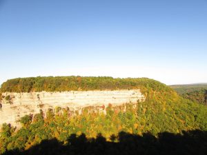
I think Natalie and I are both interested in exploring boundaries and transitions as well. The picture from her post a few weeks back, of the back porches of houses against the Greenway, is one example of the boundaries that exist currently: built home with a yard and nature path. We’re also asking whether or not the Greenway fully “counts” as a nature path, if it only exists due to the abandonment of a man-made feature. This project offers a way for us to look into the anthropocene writing influence and see where/ if we draw lines between developed area and nature, and, if we do draw that line, what does it take to reclaim nature from the developed.

Since our project spans a large area, Natalie and I are leaning toward using a lot of maps, both modern and historical on the website to place the reader as they read about the area. In our proposal we suggested a fairly basic website layout, but we’re also considering doing something a little more whimsical. I found this artist website where the main page is drawn city and the different building link to different projects the artist has done. While we’d need to figure out the logistics of doing something like this, we both like the idea of a hyperlink Greenway map that would allow a reader to pick on locations to read about them.

In terms of tools, we’re likely going to use StoryMap and/or ArcGIS (I have experience with it from different classes) as a way to create/show our maps. We also want to record audio/video to include alongside our writing on the website.

There’s a decent amount of material in our college archive, from diaries that mention the canal to sources that give the canal/railroad/greenway history. Additionally, we’re planning to visit the Livingston historical museum, which is located close to campus. We’ve also found a railroad museum in the area that we might go to, if we’re struggling to find information on the Genesee Valley Canal Railroad. Natalie is interested in doing an oral history component for our project, and, of course, we’ll document our experience and observations on the trail.

Natalie and I are still rooting through the college archives to see what threads of the story we want to pick up an write about, but we’re both super excited to see where this project goes!

Letchworth State Park

Letchworth park is known as the “Grand Canyon of the East,” which almost makes it sound like a roadside attraction. Something that should be placed besides the “World’s Largest Kaleidoscope” or “World’s smallest church,” and touted as a knock of version of something better. Of course, I can’t speak to how Letchworth Park compares to the Grand Canyon, since I’ve never been to the Grand Canyon. I can say, however, that, if I ever want to feel small against the scale of nature, Letchworth can make me feel that. The main outlook in the park is at the top of the canyon wall and looks across to the other ridge, where trees grow on slopes and scree gathers near the river. 

Now, I have to confess two things. The first is that this picture is nearly four years old, taken from when my first visit to the park. The second is that the day I was meant to go to the park to do my nature writing, I wasn’t feeling well enough to go, which means this post will be a collage of sorts, taking threads of different memories and times together into one experience.

There are three geologic processes that can generally be found in Western New York: glacial erosion/ deposition, rivers, and small amounts of uplift. Letchworth is the perfect combination of all three. The valley was shaped by both the Genesee River and glaciers going through it, and the canyon was formed by those things in conjunction with regional uplift. These processes are also what formed Letchworth’s greatest attracts: the waterfalls.

The Lower Falls, I see on a geology field trip. They’re not falling parallel to the river, which is weird. You except waterfalls to face you, but this one sits at a solid 45 degrees.  I’m told is due to the trending directions of the faults in the area. The faults, of course, are a better and easier way for water to travel. Of course, yes. Of course. The type of language every geologist has at the top of their head.

The middle falls are the hardest to find, as they are tucked away behind bushes. When my friend Laura and I found it last August, we found the best gap in the branches by listening to the water crash, calling us closer to it.

And lastly, the crowning jewel of Letchworth is the Upper Falls.

As I stand near these falls, recording the water tumbles, a mist rises to meet my camera lens and I. The air smells like water, which is to say is smells clean and sweet and slightly like shale. I can image the times I’ve walked these paths, how times have changed between visit.


My freshman year, I was part of a group of thirteen students, who were all close and did everything together. In November, we decide to visit the park to see the falls. There are a lot of group pictures, detailing the ways our lives ran into each other. Two years later, the path hold only two— a friend and me. My friend, Laura, is from England. They don’t get waterfalls where she lives, because the geologic conditions aren’t quite right for it.

When she sees this waterfall she freaks out, gushing about the way water rushes to the cliff edge and breaks along the steps of rock.

What I like about Letchworth is how it’s a place of connection, between freshman friends trying to find their people, internet friends spending their first day in person together, and, even, couples whose wedding reception tent dots the green lawn above the waterfall.

The Genesee Valley Canal/ Greenway

Archival work done on the Geneseo Valley Canal (turned railroad, then later turned hiking trail) was done through special archives sources and internet resources, mainly Flickr and Youtube. The narrative arc of this land spans nearly two hundred years, starting in the 1830’s when the idea of building a canal to Rochester from the communities of the Genesee Valley was funded by the state. Nearly forty years later, though, the canal was essentially unused and abandoned. Different legislators in the area proposed the idea of turning the old canal into a railroad, and the idea was supported by many of the newspapers in the area.

I couldn’t find any sources about what happened between the railroad being built and now, but something obviously changed. That path of the railroad/ canal has now been changed into a 90 mile hiking trail, which partially passes Letchworth State Park. What’s really interesting I think, and I’d like to explore this more in the future, is how this place of a human-made mass transport was slowly transformed into a “natural” (or maybe just natural? minus the quotations) area. That transition begs the question of  what will happen to our highways or our airports two hundred years from now? Will those places become natural as well? Or is there no real use between defining man-made and natural, if it all will eventually be seen as natural one day?