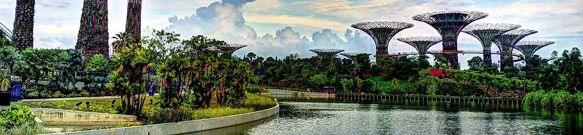
Walking around Mirror Lake in the winter is not cold because of the snow. As a park, the paths are routinely cleared, though a few packed snow tracks reveal the passing of bobcats which recently ground away the serenity. The darkness of the paved path almost feels like a gaping tunnel around the park, drawing your gaze from the blinding white surrounding you.
The cold lashes out from the wind and deceptive sunshine, both biting your cheeks and burning your skin. The cold stems from a sense of time running out, aware you need to be across several city blocks and seated in a classroom in twenty minutes. The cold contrasts with a growing frustration at the lack of information available, despite the kindness of the individuals you have spoken to. And then you find it.
Tucked in front of a skeletal bush just off the path, sitting at hip-height and covered in snow you see an information signpost. You may just race up to it so fast you slip on a hidden glimmer of ice and crash into the bush, now tangled in dormant branches and dusted in snow. You may just hesitantly clop towards it, your boot soles by now more than frozen. Anticipation builds. What piece of Mirror Lake history will the humble little sign hold which the City Engineer did not know, which the City Secretary had no information for, which the Chamber of Commerce Office Administrator could only guess at?
Mittens at the ready, you gently brush at the snow, which trickles out onto the snowy lake, dancing around the cleared hockey rinks and little red nets. Beneath the snow rests a translucent layer of ice. The scraper sits on the passenger side floor of your car winking at you from the other side of the park, traffic hissing by on the highway seemingly miles away. So you brace a fingernail against the mitten, and begin to scrape for all you’re worth. The picture you uncover rests below.
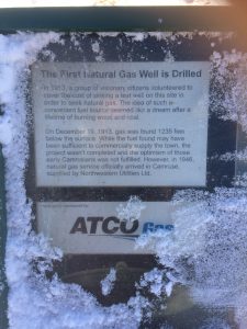
Having taken the one picture, out in the cold for a total of fifteen seconds, your phone decides to shut off. You breathe in the chill air, looking up into the blinding snow and sunlight. Success! … And your nose begins to drip.
City Engineer Jeremy Enarson can find archival sources from 1975 to the present on the maintenance and planning for Mirror Lake. Strangely enough, few sources exist prior to that time. We only have that far back because of maintenance programs in the 90’s which sought out the older plans for the dam. In the few aerial shots of the city and surrounding areas, we can see that Mirror Lake has kept her current shape and appearance for at least the last half century. Myths of damming the creek for a water supply for steam locomotives stretch as far back as the early 1900s, and we could potentially search railway records for more information.
I think the limitations of the archival data available offer an opportunity for increased creativity, focusing on the documented recent past, oral histories of the mythic past and personal connections to the lake (including someone who spearheaded a naming contest for the lake in the 1970s or ‘80s!!). I think StoryMap will work well for this project, as we can connect historical pictorial views of the Lake with the approximate vantage point of where they were taken, and offer a unique visual tour of the area for those unfamiliar or unable to visit. The signposts situated around the Lake with more interesting public history would also be interesting to place on the map.
I would have liked to be able to manipulate the background map a little more, as the lake is a grey blur, the park area a speckled mirage, and the roads obnoxiously bold. Both roads and railroads appear the prominent focus, despite the centrality of the Lake (which took SOOOOOOO MANY attempts at placing pins, you would not believe). But these also offer opportunity to critique our human-centred view of landscape.
We split the experimenting in half. Curtis made a TimeLine. And below you will be able to find my first attempt at developing a StoryMap. You may have to let him load for a moment, as he’s just waking up and doesn’t like to be disturbed. He is little, and a little simple, but I see the potential for great growth.
g
